
Click image for a larger view
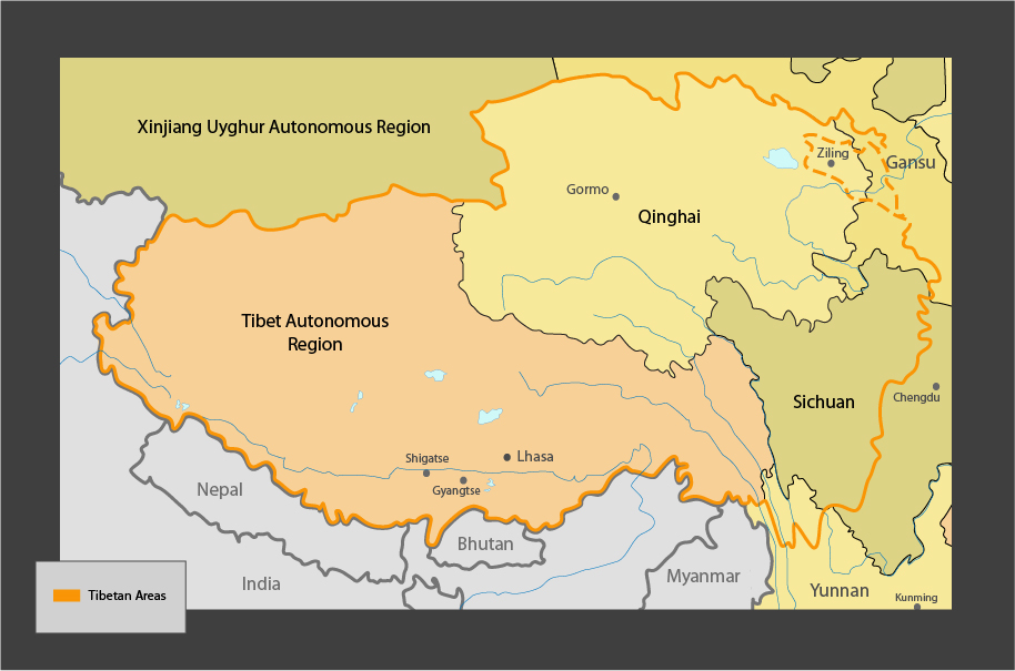
The map (above) used in ICT reports takes no authoritative position on the political boundaries of Tibet. The map includes the political boundaries of provinces within the People’s Republic of China (PRC). For clarity, the orange line indicating “Tibetan areas” generally tracks the areas designated as autonomous for Tibetans by the government of the PRC. The line is dashed around Xining (Ziling) to reflect the dispute over this area. The boundaries of Tibet as defined by the Central Tibetan Administration can be found at http://tibet/net/map-of-tibet.
Note on geography:
Tibet was traditionally comprised of three main areas: Amdo (north-eastern Tibet), Kham (eastern Tibet) and U-Tsang (central and western Tibet). The Tibet Autonomous Region was set up by the Chinese government in 1965 and covers the area of Tibet west of the Dri-chu (Yangtse river), including part of Kham. The rest of Amdo and Kham have been incorporated into Chinese provinces, and where Tibetan communities were said to have ‘compact inhabitancy’ in these provinces they were designated Tibetan autonomous prefectures and counties. As a result most of Qinghai and parts of Gansu, Sichuan and Yunnan provinces are acknowledged by the Chinese government to be ‘Tibetan.’ ICT uses the term ‘Tibet’ to refer to all Tibetan areas currently under the jurisdiction of the People’s Republic of China.